
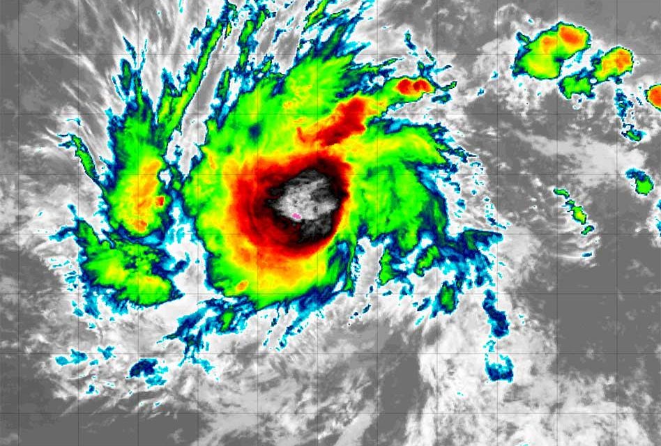
A tropical depression has emerged in the central Atlantic Ocean, catching meteorologists’ attention for its early appearance in what is typically a quiet period of the Atlantic hurricane season in June. Designated as Tropical Depression Two, this weather system is expected to intensify into Hurricane Beryl by Sunday, according to forecasts from the National Hurricane Center.
As of Friday evening, Tropical Depression Two was located approximately 1,400 miles southeast of the Windward Islands and moving westward at a speed of about 21 mph. Its current maximum sustained winds are measured at 35 mph, but meteorologists anticipate significant strengthening. By Sunday afternoon, the depression could potentially reach hurricane status with wind speeds up to 100 mph [4].
If Hurricane Beryl materializes, it would become the first hurricane of the 2024 Atlantic season. The projected path of the storm suggests it poses a potential threat to the Windward Islands and other parts of the Caribbean in the coming days. Local authorities and residents are advised to closely monitor its progress.
The NHC has warned of potential risks including heavy rainfall, hurricane-force winds, dangerous storm surge, and high waves for the Windward Islands by Sunday night or Monday morning. Consequently, hurricane and tropical storm watches are likely to be issued for portions of the Windward and southern Leeward Islands by Friday night or Saturday.
To gather critical data on the storm’s intensity and trajectory, hurricane hunter aircraft are scheduled to investigate Tropical Depression Two on Sunday.


